
Home / Camping / Canada / Ontario / Bon Echo Provincial Park
Bon Echo Provincial Park
Verified from official source
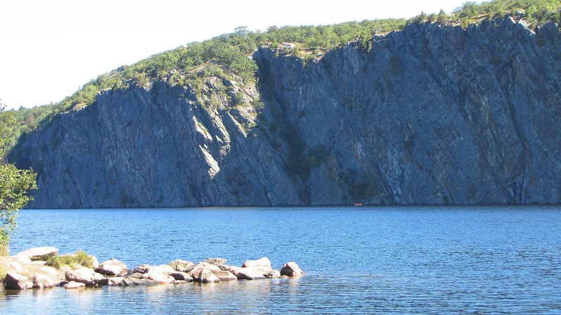
Bon Echo Provincial Park covers 8294.00 hectares and was established in 1965 as a Natural Environment park. It features the 100 metre high Mazinaw Rock with over 260 Indigenous pictographs, hiking trails, a Visitor Centre, and various camping options.

Check availability Official park page
Directions
More places in Ontario, Canada.
Drive time
We show straight-line distance only. Use Google Maps for driving time — we do not call a routing service.
Nearby
Straight-line distance from the park pin, not from a specific entrance. Cached from OpenStreetMap; may be incomplete or out of date. Hospital distances are also straight-line from the park pin, not driving time.
Grocery
- Cloyne General Store 12.0 km
- Foodland 21.5 km
- Freshmart 22.7 km
- James General Store 22.8 km
Gas / fuel
- Fuel station 10.0 km
- Shell 11.9 km
- Woods 12.4 km
- Petro-Canada 20.6 km
Dump station
- Dump station 38.7 km
Hospital (straight-line from the park pin)
- North Hastings Hospital 49.7 km
- St. Francis Memorial Hospital 71.8 km
- Renfrew Victoria Hospital 77.5 km
- Lennox and Addington County General Hospital 78.3 km
Beaches
- Little Cuba 9.1 km
- FVLCC Private Beach 32.2 km
Trails
- Juniper Trail 37.8 km
- Sumac Trail 37.9 km
- Crow Trail 38.1 km
- Cattail Trail 38.2 km
Attractions
- Boat Ramp 5.9 km
- Bon Echo Visitor Centre 5.9 km
- Old Fireplace 5.9 km
- Cliff Top Viewing Platforms 6.3 km
© OpenStreetMap contributors (ODbL)
Rates and fees
Official 2026 camping fees are published on the Ontario Parks camping fees page. We do not copy dollar amounts here; confirm the current rate for the campground and dates you want. Book through the Ontario Parks reservation system.
Season dates
Open now / closes 13 December 2026. Official dates vary by campground or site.
From the official park page, last checked 20 November 2026.
- Bon Echo: 2026-05-08 to 2026-12-13 (official dates vary by site; earliest open and latest close shown)
Check-in and check-out
Check-in: After 2:00 p.m. (Ontario Parks car camping and backcountry rule).
Check-out: Before 2:00 p.m. (Ontario Parks car camping and backcountry rule).
Official source: Ontario Parks reservation rules.
Office hours
Check with the park — hours were not listed in a form we could confirm on the official park page.
Sites and amenities
- Number of sites: 530 sites total; 495 car-camping; 214 electrical; 26 backcountry
- Electric hookups: Yes
- Water hookups: Check with the park
- Showers: Yes
- Drinking water: Check with the park
- Toilets or restrooms: Check with the park
- RV length limit: Check with the park
- Waterfront, swimming or launches: Yes
- Winter camping: No
- Accessible sites: Check with the park
- Pets: Yes — The official park page lists 1 dog beach and 1 pet exercise area. Ontario Parks' dogs page lists Cabin 612 and Yurt 157 as dog-friendly roofed sites (fee and two-dog limit apply). Check the park for current leash and area rules.
- Wi-Fi: Check with the park
- Reservations: Yes, through the official Ontario Parks reservation system.
From the official park page
- 100 metre high Mazinaw Rock featuring over 260 Indigenous pictographs
- Great hiking trails from 1 km in length to 17 km in length
- Learn more about park history in the Visitor Centre or attend one of the popular Discovery programs
- Camping experience for everyone: RV, car camping, backcountry, and roofed accommodations
- Interior canoe-in and hike-in sites available
- Friends of Bon Echo Festival of the Arts
Sources
Last checked: 20 November 2026.